
Map of NYC's Chain Stores, from http://www.weathersealed.com/2009/12/08/miraculous-34th-street/
Here are some cool maps on New York City (and yes, I am aware that for the most part, this means Manhattan below 96th Street! But what can one do?). Ahhh....New York City, aka The Big Apple. Or “the big stinky apple,” as one of my nephews calls it (btw, he’s NOT a New Yorker, obvio!). With a few exceptions, they are all relatively recent maps. I couldn’t resist adding in a couple of vintage examples, such as the Beerdom Map of the Lower East Side (1885). And some of them, strictly speaking, are not maps at all, but are geographic representations in one way or another. Some of the maps are funny, some are interesting, some are really, really cool, and some are just downright weird. That about sums up NYC, as well – funny, interesting, cool, and weird. And maybe stinky, especially if we have a garbage strike this summer!
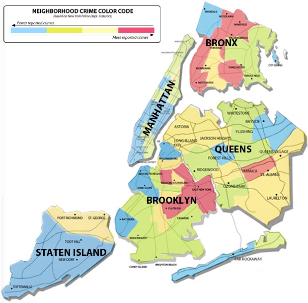
Maps Showing Basic Facts about NYC

3-D Map of Lower Manhattan, overlain on an historic map
Google Earth has added part of the David Rumsey Historical Map Collection to their software. That means you can now generate cool images like this one, with modern day NYC buildings superimposed on the old maps. Neat!

“Where are all the rich, single guys in Manhattan? Why, the East Side and Chelsea, of course. We figured that out using GeoIQ’s heatmap technology, which displays information using futuristic gradient shading.”

NYC Photo-taking maps
Taking city maps and overlaying them with the frequency of photo taken and posted to Flickr by local residents as compared to tourists.
Blue pictures are by locals. Red pictures are by tourists. Yellow pictures might be by either.

NYC Play Around Map
PlayaroundNYC map, which aims to help New Yorkers identify areas that are well supported by playgrounds and have suitable conditions nearby (ie. not underneath a highway overpass, as some of our “playgrounds” up in the Bronx are located).
Transparent NYC
This very cool website has interactive mapping capabilities that allows one to look at multiple layers of information “transparently” for several time periods. Check it out.

NYC Buzz Maps
Above “are maps from a study, called ‘The Geography of Buzz.’ The authors, Elizabeth Currid, an assistant professor in the School of Policy, Planning and Development at the University of Southern California in Los Angeles, and Sarah Williams, the director of the Spatial Information Design Lab at Columbia University‘s Graduate School of Architecture, Planning and Preservation, mined thousands of photographs from Getty Images that chronicled flashy parties and smaller affairs on both coasts for a year, beginning in March 2006. The maps show the density of different types of cultural events in New York.”

“Notice that three-fourths of Manhattan is essentially uninhabitable by any sort of normal person. Note too, though, that these prices are from 2006, before the real estate bubble popped. And Wall Street bankers are not doing quite so well these days. It'd be interesting to see what the map would look like today.”

This one is price per square foot of actual land, whereas the one above is price per square foot of building space.

Graffiti on NYC Subway Map
“Thanks to Kid Lew for giving me the chance to hit up this NYC subway map with artists like David Choe, Mad, Andrew Bell and many others. Enjoy. 9.”

Eminent Domain Map of Manhattan
This map illustrates the use of eminent domain, which is the right of a government to seize property, ostensibly for public use and benefit, but often for private profit. “The sites of eminent domain range from the early condemnations for public parks and streets in the 19th century to the vast condemnations during the Robert Moses era for highways, railways, parks, office buildings, universities, cultural and convention centers, and public and private housing projects to contemporary sites, such as the New York Times building, the Atlantic Yards project, Willets Point, and the Columbia University expansion.”
From: http://www.brooklynartscouncil.org/forum/1573 Eminent domain map by Bettina Johae
Ethnicity and Race and Place in NYC

New York City is still an extremely segregated city, as is vividly demonstrated in this dot density map. This is one in a very good collection of dot density maps of various US cities/urban areas. The maps are by Eric Fischer, and you can see the whole collection (108 cities) at http://www.flickr.com/photos/walkingsf/sets/72157624812674967/?page=2
Bill Rankin, at Radical Cartography, developed this particular format of dot density mapping the various racial and ethnic groups, with Chicago, IL, and he has a wonderful explanation of the use of dot density maps to show urban transitions, on his blog at http://www.radicalcartography.net/index.html?chicagodots
More on these maps:

Ethnic Concentrations based on International Telephone Calling Patterns
This is way cool! And probably a better indicator than the census regarding the concentrations of ethnic communities and immigrants. Researchers from the “senseable city laboratory” at the Massachusetts Institute of Technology have created a novel project that reveals the complex dynamics of talk that exist between New York and other cities around the globe. The project, called New York Talk Exchange, is based around an analysis of telecommunications traffic flowing to and from New York City. From: http://web.mit.edu/newsoffice/2008/nyte-0218.html

Jewish New York: A History & Heritage Map from: http://www.newyorkology.com/archives/2007/11/finding_sarah_j_1.php
You can also find other maps in a similar vein for the East Village punk rock scene and earlier genres of music and art, (complete with little caricatures of the Ramones, Talking Heads, CBGBs, Jean-Michel Basquiat, etc.) as well as one for the Harlem Renaissance, the Queens Jazz Trail, and Lower Manhattan, at Ephemera Press http://www.ephemerapress.com/press.html

NYC Principal Nationalities Map, 1895
Based on 1890 Census data. Each pattern reflects a different ethnicity.
This is a fascinating look at where various foreign-born populations settled in NYC back in the end of the 19th century.


This map of the 11th Ward in lower Manhattan was published by the Christian Union newspaper, along with an article lamenting the fact that in this one neighborhood which was surveyed by temperance supporters, there were only 19 churches and synagogues, but over 340 saloons, catering to the mostly German population, who, according to the article, used to drink themselves blind every night. I used to live in this neighborhood, and I can attest to the fact that there are STILL many more watering holes than places of worship!
See also recent blog posting on the topic of ethnic enclaves in NYC at http://geographer-at-large.blogspot.com/2011/06/new-littles-mapping-ethnic-enclaves-in.html
NYC Tourism Maps and Maps Showing Places of Interest

What is up with this map? Why are the five boroughs of NYC superimposed in an incorrect location on the map of New York State? Why are the boroughs shown so generalized that they are almost unrecognizable? Why are they in a totally different scale than the state map? What kind of useful information does this give the tourist, who is likely to think that NYC is in the middle of the upstate New York, and taking up more than half the size of the state, and is amongst the strangest and most amorphously-shaped geographical features ever seen. Boo to whoever put this atrocity together!
NYC Safety Map for Tourists
Here’s another objectionable one – this one is quite nice cartographically, but what is up with telling tourists that the only safe areas in NYC are the white people zones?

Manhattan Movie Icons Map
Ok, this one was featured in an earlier blog posting, but I liked it so much, I’m posting it again! See how many of the movies you can name. See

NYC SitCom Map
From: http://danmeth.com/
One darned funny cartoonist!
One darned funny cartoonist!

NYC Rock ‘n Roll Map


NYC Landmarks Map
See how many you can identify. The landmark names are written beneath each landmark, but they are a little difficult to read. See how many you can name without cheating!

NYC Literary Map
Bad Stuff in NYC


NYC Hurricane Evacuation Map - Most of the city is just above sea level, after all! For more complete and up-to-date information about Hurricane Irene and NYC evacuation zones, see August 25, 2011 posting http://geographer-at-large.blogspot.com/2011/08/irene-plans-to-visit-new-york-city-this.html

NYC Foreclosure Map

Detonation Effects Map
Typographical and other Specialty Maps of NYC
And here we have a sub-category of maps made from Typography and other clever methods

Manhattan Map with Neighborhoods Delineated by Type

Typographical Green Spaces Map

Random Typography Map of Manhattan

NYC Cut-out Map (scherenschnitte - scissor cutting style)

Map of the Design Formed by NYC Street Grid, with Interstitial spaces between the streets (the property lots, more or less) re-arranged in a series
«Anagrammes graphiques de plans de villes» by Armelle Caron
OK, you just have to look at this to really figure out what it is. Pretty interesting and clever. Check out link below to see other cities: Istanbul, Paris, Berlin, etc.
And here we have a sub-category of Mental Maps of NYC


This is a recent New Yorker magazine cover, 35 years after the original one, showing New Yorkistan and all the little stans within it. In the months after 9/11, Maira Kalman and Rick Meyerowitz's ethnic breakdown of the boroughs sold more New Yorker magazines than any other cover in history.

Mental Map of New York, from a native Montanan’s perspective.

Car Tow Story
This is every New Yorker’s nightmare, and even worse for visitors to the city: what happens when your car is towed. It's the 9th Circle of Hell......

Welcome to New York City – a map for some kind of game based on the subway system.

1950’s embroidered cartoon map showing NYC landmarks. The attractions outside of Manhattan (Coney Island, Yankee Stadium, Bronx Zoo, LaGuardia Field) are just kind of floating in the East River, and the disembodied bridges go from Manhattan directly into the water..... But hey, at least the map shows Washington Heights and The Cloisters, for a change!

Neighborhoods/Places of Interest Map of (part of) Manhattan
I truly don’t really understand this map. What are the little faces supposed to denote? Why are many things in the wrong place? Why does Manhattan not include Washington Heights and Inwood? Nevertheless, it is somehow pleasing, graphically. I wonder if the expressions on the little faces are supposed to indicate anything about the areas they are in, like those maps that use Chernoff faces as symbols to depict socio-demographic characteristics.
Unconventional Maps Exhibit
There was a recent exhibit called “Unconventional Maps” at Pratt Gallery. You can see some more of the entries at:
Two examples from the exhibit:


Very interesting collection! A few observations: now that New York has finally passed gay marriage some of those rich, "single" guys in Chelsea are going to be married off. I would have rather seen the sitcom map as a point map. The "Taxi" garage is still there (I think) on Hudson Street and Lucy and Ricky (from "I Love Lucy" for those who have never seen a show older than twenty years old) lived at 623 East 68th Street which would be in the East River.
ReplyDeleteAbsolutely! I was thinking the exact same thing about Chelsea, even before the same sex marriage bill passed! As to the real life location of the TV show "Taxi," alas that is no longer there. For many years I used to live around the corner from that place, which was on the southeast corner of Hudson Street and Charles, I believe. In any event, the little two story building was demolished and a big fancy apartment building was put up instead, with a Duane Reade or Rite Aid pharmacy on the ground floor in the exact place where the Taxi building used to be. This happened quite some time ago, more than 10 years. So many changes to the old nabe. NYC, more than most cities, morphs and reinvents itself quite amazingly from one decade to the next. When I first moved into the Far West Village, there was an actual pony farm between Greenwich and Washington Streets. Yes, a pony farm!
ReplyDeleteYou may like this jacob riis historical photography of new york slums etc http://www.bartleby.com/208/
ReplyDeleteGreetings, CEENTV - thanks for the link. I had done a posting on Jacob Riis and "How the Other Half Lives" a couple of months ago, and also gave a link to a facsimile version of the book, but the link you provided is a much better one actually. Check out my post at http://geographer-at-large.blogspot.com/2011/01/how-other-half-lives-tenement-life-in.html
ReplyDeletePS - I ended that post with the famous last words "When the Map Monkey has more time, I will expound in greater length on the evolution of the tenement form in a future blog posting" but of course I never have gotten around to it. Perhaps this will inspire me to do so! Thanks again.
Have you seen City Maps yet? It is AMAZING and seems like something you would really like. It is a new age map, interactive and live.
ReplyDeleteThis is really cool. What an awesome collection!
ReplyDeleteWhere did you find the blue map of Manhattan? I have searched absolutely everywhere but cannot find the source.
ReplyDeleteSorry I'm talking about the typography one! haha It says "Manhattan Map with Neighborhoods Delineated by Type"
ReplyDeleteI'm from Houston, Texas and I love New York City!! Nice page!!
ReplyDeleteI have to protest there is no Bruce Springsteen on that rock and roll map.
ReplyDelete"10th Avenue Freezeout" and some others too.
Also Joni Mitchell "Chelsea Morning."
I like this you can also see oh
ReplyDeletewordpress business themes
go the best travel and tips with us please contact :- There are some workings New York city jet ski rental in with in term based correct places for naturally making sure what all are perfect by the place of jet ski rental new york city better in greater manner.
ReplyDeletethanks for inspired me!agen Bola Online Terpercaya
ReplyDeleteeCommerce Web Development Singapore
Thanks for Fantasctic blog and its to much informatic which i never think ..Keep writing and grwoing your self
블랙존사이트
해외토토사이트
경마사이트
크레이지슬롯
하나라이브
https://ocn2001.com/
Best seo company in Lahore
ReplyDeleteBest seo company in Lahore
Best seo company in Lahore
bitsourceit
ReplyDeleteWonderful post. Thanks for sharing for your brilliant content. http://www.logicalhousing.com/
ReplyDeleteBest SEO Company in Dubai
ReplyDeleteBest SEO Company in Dubai
Best SEO Company in Dubai
Best SEO Company in Dubai
Best SEO Company in Dubai
Thanks for provide great informatic and looking beautiful blog, really nice required information & the things I never imagined and I would request, wright more blog and blog post like that for us.....downtown LA
ReplyDeleteSugoi dekai meaning
ReplyDeletesugoi dekai meaning US Sugoi Dekai is a Japanese saying or phrase that means “Very much so”. The phrase "Sugoi Dekai" contains two words' Sugoi '&' Dekai'.Sugoi means great, strong, great, wonderful, wonderful, and wonderful. Also, Dekai means great, great and great sugoi dekai meaning.
Architectural consultants in Dubai
ReplyDeleteArchitectural firms in Dubai
Adana
ReplyDeleteElazığ
Kayseri
Şırnak
Antep
UZOH2M
34144
ReplyDeleteBalıkesir Parça Eşya Taşıma
Karabük Lojistik
Iğdır Lojistik
Erzurum Lojistik
Osmaniye Parça Eşya Taşıma
146AE
ReplyDeleteAnkara Lojistik
Niğde Lojistik
Kocaeli Şehirler Arası Nakliyat
Probit Güvenilir mi
Amasya Parça Eşya Taşıma
Silivri Evden Eve Nakliyat
Afyon Şehir İçi Nakliyat
Karabük Şehir İçi Nakliyat
Bingöl Parça Eşya Taşıma
E2ACF93721
ReplyDeletetürk beğeni satın al
6A444F239F
ReplyDeletetwitter takipçi
1F016F7772
ReplyDeleteinstagram çok ucuz takipçi
beğeni satın al
bot takipçi
organik takipçi
telafili takipçi