Partial view of the Maerschalck Map (1763), indicating the location of the “Negroes Burying Ground” (from Stokes, Iconography of Manhattan Island, Vol. 1).
The African Burial Grounds: An Update and Some Reflections
Background:
In 1991, excavation began for a new $290 million dollar Federal office building on Duane Street and Broadway in lower Manhattan. But shortly after breaking ground, construction work was thrown into a turmoil, and ultimately was temporarily halted, when evidence of human remains was found below the surface of the site, which had not previously been excavated for development to that depth. They had unearthed what has since been determined to be the largest colonial-era cemetery for enslaved African people in America. There then followed many tense months of negotiation, public outreach, investigation, reporting, editorializing, vitriol, lots of passionate expounding, historical research, cost-benefit analyses, legal review, compromise, and eventually, archaeological digging under extreme time pressure, all of which proved very controversial with a number of various political, religious, and cultural groups in NYC.
I thought it would be appropriate on this, the 20th anniversary of the “re-discovery” of the graveyard, now called the African Burial Grounds (ABG), to offer a brief history of the site, an update on the current status of graveyard, and to excerpt some written reflections that I made 20 years ago on the occasion of my visit to the site while the archaeological dig was in full swing. I consider my visit to the site to be one of the highlights of the decade for me, and a supreme privilege.
The African Burial Grounds National Monument, designated in 1993.
Source: National Parks Service.
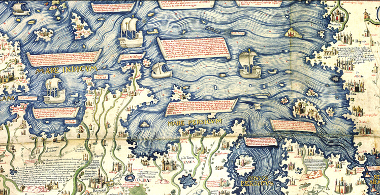
The African Burial Grounds, or “Negroes Burying Ground,” as it was called back then, appears on several well-known maps of the 18th century, so it is somewhat surprising that it was so completely forgotten about or ignored in the intervening years. It is estimated that the burial grounds occupied roughly 7 acres, and contain up to 20,000 interments, mainly people of African birth or descent, most of whom had been transported to NYC involuntarily as slaves, either directly from Africa, or with an intermediate stop of indeterminate duration in the West Indies, or were born here in bondage. There were also a number of free black people buried here, since during the Dutch governance of the city about half of the black people living here were free or “half-free.” The Federal Building site is only one small corner of the original ABG, containing perhaps 450 graves. The remainder of the graves still lies, some disturbed and some undisturbed, underneath what are now streets, courthouses, office buildings, and retail stores in the City Hall/Financial District of Lower Manhattan. The burials took place mainly in the 17th and 18th centuries, when this area was outside of the city limits proper (above Wall Street). Black people were not allowed to be buried in consecrated ground in church graveyards, even if they were Christian, nor were they permitted to be buried alongside white people. This was true for both free black and enslaved people. By 1800, the city was rapidly growing northward, and the swampy, low-lying site of the ABG was land-filled and platted for development.

David Grim map, 1742, showing area near the Collect Pond as a site for the Punishment of Black people (note the hanging scene and burning-at-the-stake depiction on the map). Source: The African Burial Ground Project, Howard University, Washington, DC, “New York African Burial Ground Archaeology Final Report," Vol. I, 2006.
The Ratzer Plan, partial view, 1767, showing the types of noxious and dangerous land uses near the Collect Pond (“Fresh Water”) and the burial grounds – e.g., tanneries, powder houses, etc. Source: The African Burial Ground Project, Howard University, Washington, DC, “New York African Burial Ground Archaeology Final Report," Vol. I, 2006.
The Taylor-Roberts Map, 1797, showing the area near the Collect Pond as being already platted for development, if not already built upon. Source: The African Burial Ground Project, Howard University, Washington, DC, “New York African Burial Ground Archaeology Final Report," Vol. I, 2006.
Excerpt from my written reflections upon visiting the archaeological dig in 1992:
Some Thoughts on the Foley Square Burial Grounds (June 16, 1992)
As I sat on the subway returning from the Foley Square archaeological site, I glanced down at my black clodhopper boots. They were covered in a fine dusting of soft brown dirt. This was not your typical hot-summer-in-the-city grime and grunge, nor your average walk-in-the-country mire-and-muck. This was eighteenth century dirt, and as I contemplated the significance of that, a frisson of historic appreciation ran down my spine.
I realized, not for the first time, that the past means a lot to me, probably more than it means to many others. This difference in values (in the sense of what one considers valuable) is always at the crux of the conflict between archaeologists and real estate developers. But in the case of the Foley Square site, this conflict becomes heightened and more multi-faceted, because this is not an ordinary repository of antique house remains and remnants of everyday living, or even fragments of an historically significant building, like the Stadt Huys, New York’s original Town Hall. Instead, the Foley Square site is part of a vast 18th century burial grounds, primarily for Black Americans, and as such its discovery and disturbance dredges up emotions and dilemmas in the public arena that archaeology, for better or worse, does not usually inspire.
The disposition of human remains has become a sensitive issue in the scientific world, but among regular folk, feelings run particularly high when the bones in question might belong to one’s ancestors. Many reputable museums and educational institutions have had to justify their analysis, destruction, and/or displays of human skeletons, and in certain well-publicized instances involving Native American remains, have had to relinquish these “artifacts” to the descendants of the disinterred. Studies of burials and human remains can provide us with much information about demographics and the socio-economic condition of the population, through the data about disease, nutrition, and stature obtained through skeletal analysis. The layout and surface appearance of the cemetery, and the presence and types of grave goods can tell us about the funeral customs and degree of acculturation in the populations. In the case of groups that have, for one reason or another, “escaped” the historic record, cemetery investigation offers an opportunity to gain information which might otherwise e unobtainable.
However, archaeologists, who in this country happen to be predominantly white, have often been accused of cultural insensitivity by people of color, tribal people, and non-Westerners, who cite as a prime example what appears to be their cavalier attitude and irreverence when dealing with the physical remains of non-white people, treating them as mere specimens. After all, archaeologists do not usually go up to the 18th century graveyards of New England to dig up somebody’s great-great-grandmother to analyze her bones (although maybe they have!).
And yet, within the “Black community,” which is of course far from monolithic, there are many differences of opinion. One faction, comprised of ultra-religious people, tends to think of any disturbance of these graves as desecration and sacrilege, even in the pursuit of scientific and historic knowledge, while others are enthusiastic about studying the burials, looking forward to the window that will be opened on our understanding of Black New Yorkers in the 18th century. Given the strategic and symbolic location of the burial site between City Hall and the Court Houses, it could bring recognition and prominence to the contributions of Black New Yorkers, and an understanding of the role they played in New York’s history. The historic and cultural importance of the site is actually national in scope, when taking into account the number of burials, the age of the gravesites, and the new information it tells us about living conditions for Black people in the New World.
Most people know little about the long and rich history of Black people in New York. This information gap includes, I would venture to say, even many Black New Yorkers, too. This is perhaps to be expected. After all, the majority of us, regardless of racial or ethnic background, can trace our ancestors’ arrival (or our own arrival) in New York only as far back as the late 19th century and up to the present. Black New Yorkers’ history doesn’t start just with Harlem in the Jazz Age. New York had a large Black slave population in the 17th, 18th, and even early 19th centuries, alongside a large free Black population. In fact, New York was a capital of slavery, surpassing every city in colonial times in numbers of slaves, except Charleston, South Carolina.
In the 17th century, the Dutch began the first Black American community in the New Netherland province by capturing four African men from a Portuguese slave ship bound for Brazil. The Dutch seemed to have a more enlightened view of slavery than their other European contemporaries, often considering Black people to be “half-free” and even allowing them to own their own land. Cynics, however, would see this less as enlightened behavior and high moral virtues on the part of the Dutch than a pragmatic economic necessity.
The Dutch were nothing else if not practical in business matters, their touted tolerance usually being born of expediency. New Amsterdam was being colonized at the time of Holland’s “Golden Age,” a time of peace, prosperity, and cultural flowering, and there was really no dissatisfied, disaffected, deprived, or religiously-persecuted underclass in Holland to settle the New World colonies, as there was, for example, in England at that same time. The Dutch West Indies Company had difficulty recruiting colonists at all, since New Amsterdam was the ends-of-the-earth wilderness. Slaves made it possible to produce the food and goods necessary for life in the new territories. By giving the slaves half freedom, the Dutch masters absolved themselves of the responsibility for their slaves’ physical well-being and expensive up-keep. It also alleviated the Dutch of the necessity for close supervision of the slaves, which would have been nearly impossible, given the extreme manpower shortage of the Dutch. By granting the Black people land to farm in the northern reaches of the city, (in what is now Greenwich Village, Chinatown, Soho, and Noho) the Dutch had ensured a steady supply of food for themselves, as well as created a protective “buffer” between themselves and the sometimes hostile Native Americans.
The English had a more rigid view of slavery, and after they gained control of New Amsterdam in 1664 and renamed it New York, they severely restricted the rights of Black tradespeople and farmers, denying them their rights to own land and practice certain skilled trades. They also instituted a legal and enforced segregation of Black people, which carried over from life into death, and prevented Black people from being buried with whites or in any consecrated grounds.
Black people were very beneficial to both the Dutch and the English versions of the city, and it is doubtful that the colony would have prospered without them. Many were skilled artisans, and productively worked and contributed to the success of the colony alongside their white counterparts. The “invisibility” of Black history in New York City partially accounts for the importance of the Foley Square site: it is hoped to become the means, in some small way, of redressing the injustice and the imbalance of the historic record, and to give voice to the silenced ones, so that we may all learn.
The “Negro Burying Grounds” appear on several maps throughout the 18th century. The area to which they were relegated was a swampy undesirable part of town, fairly far removed from the then-limits of the city. It was near the Collect Pond, at the time the source of fresh water for the city. Around the Pond were various nuisance uses, such as tanneries, slaughterhouses, and pottery kilns, which were deemed too polluting, smelly, or dangerous to be located in the more densely populated parts of town. Amongst those “nuisances” was the Negro Burying Grounds. Even though many Black people had become Christians, they were not permitted to be buried in church grounds. The graveyard, which was also used to bury prisoners of war, epidemic victims, and other “undesirables,” was in use from the late 1600’s to about 1792, when the land was platted and sold as building lots. Although it was a known fact that the burial grounds were located there, builders dug foundations throughout the intervening years, which disturbed some graves and left others unscathed (if paved over) depending upon the depth of the foundations and the natural slope of the land.

The Maerschalck Map of 1754, showing the Negro Burial Grounds near the “Fresh Water” (the Collect Pond). Source: The African Burial Ground Project, Howard University, Washington, DC, “New York African Burial Ground Archaeology Final Report," Vol. I, 2006.
Detail from Robinson and Pidgeon Atlas, 1893. Manhattan Alley was never built upon and therefore the burials beneath it were/are intact. Note the dense commercial development of the burial ground site by this date. Source: The African Burial Ground Project, Howard University, Washington, DC, “New York African Burial Ground Archaeology Final Report," Vol. I: 93, 2006.
At this time, [June, 1992] the archaeological dig has been underway for the past 9 months, yielding some 380 burials so far. The dig site itself, to the unsuspecting, looks nearly identical to any ordinary high-rise construction site. There is a large construction sign indicating all the principal players – the owners, engineers, architects, contractors, with a full-color rendering of the proposed building. Nowhere is there any acknowledgement of the archaeological work or any indication that the construction of the building has been virtually halted by the archaeologists’ work. If you look through the little portholes in the construction fence, you see an almost block-square L-shaped excavation about 30 feet below the street level, with poured concrete foundation walls defining the area. Then you notice 6 or so plastic-roofed barrack type structures lining two walls, and facing each other. And the huts are swarming with long-haired sandal-wearers, not your typical construction crew.
On the floor of the excavations, the director of the archaeology team, Michael Parrington, explained that in the 18th century, the ground level would have been 25 feet or so lower than the current street level, and that we were now standing about 5 or 6 feet lower than that. In fact, I was at the level of the burial pits, and the graves being excavated are less than 18 inches below the ground I stood on. Two archaeologists worked on each burial pit, and the tent I toured seemed to have about 6 burial pits under various stages of uncovering. Bodies were usually interred east-west, in the African, Muslim, and Christian manner, with the deceased lying flat on his back.
One team was just at the top most layer of the coffin demarcation, there being nothing left of the actual coffin wood save some discoloration of the dirt, creating a hexagonal outline, and some corroded and fragile coffin nails. Few remnants of coffins have been retrieved, excepting one spectacular find of a coffin lid with nails outlining the deceased initials and date of death. Some skeletons have been found with coins (originally placed over the eyes, it is supposed), but there were few other grave goods. One woman’s skeleton was found with a belt of cowrie shells and beads in the African fashion, and some skulls were found with filed teeth, also reflecting African customs or origins.
Some of the deceased were buried in clothing, and occasionally buttons have been recovered.
But many bodies were buried only in shrouds, especially the children.
About 25% of the burials that have been found are those of infants and the very young, and almost half of all the burials are children under 15 years of age, illuminating the incidence of epidemics, disease, malnutrition, poor sanitary conditions, lack of medical care, and high rates of infant mortality.
Forensic archaeology can also tell, based on wear and tear of the skeletal structures, that many of the people, even the young people, had incredible stress exerted on their muscles and were over-worked, with lifting, hauling, and other repetitive heavy labors.
A Burial Pit under excavation.
Another team was working on a deeper pit, where the skeleton was already visible. Although crushed and disarranged, it was still recognizable as a fellow human being with swirls of coffin wood embedded in the skull and legbones. It was not gruesome or morbid, only poignant and evocative, as I thought about this New Yorker from two centuries ago, possibly born in Africa or born here into slavery, almost certainly here against his or her will. I thought about how he or she lived, perhaps even happily, but certainly not easily, maybe had a family, worked hard, and tried to make sense of this world as we all do, and died at too early an age. The burial rites of the Black people were perhaps one of the only occasions they had to participate in their own cultural community, and to celebrate customs that persisted from Africa. In other aspects of life, these customs were denied to them, and laws prohibited congregation of more than three Africans. Funerals were therefore an opportunity to gather and commemorate in their own way.
Due to pressures from the Federal government to get the construction of the office tower started again, the archaeologists are working 12-hour days, 6 days a week. After the burials are excavated, the remains will be analyzed in the lab, a lengthy and painstaking process estimated to take several years. Some feel that the bones should be re-interred in their original graves after analysis, which could halt construction indefinitely. Others are proposing re-burial in a nearby public space like Tom Paine Park opposite the Supreme Court building. Others say the proposed Federal building should be redesigned to accommodate a museum and a memorial park be installed in the place of the proposed parking structure.
The site should be considered analogous to Ellis Island or the Statue of Liberty. It has spiritual and historic importance to the national heritage of all Americans, and ought to be made much of. National Park status would be appropriate. Many Americans consider it sacred ground.
[Thank you, Jean Howson, for arranging my visit to the site]
The African Burial Grounds and Commons Historical District. Source: New York City Landmarks Commission Map.
Update on the ABG:
A small part of the Federal Building site was set aside and made into a National Monument, which is operated by the National Park Service and open to the public (M-F, 9 AM - 5 PM, same as the office building). The bodies that had been disinterred were re-buried on the site - not in their original grave pits, but in coffins hand carved in Ghana with village scenes and traditional symbols and interred in specially-designed crypts made of African Mahogany. Special artwork commemorating the ABG was commissioned and installed, and there was a re-dedication memorial service in 2003, “The Rites of Ancestral Return.”
The design of the “New Ring Shout” commemorative artwork
The ABG artwork that I like the best is “The New Ring Shout,” installed in the floor of lobby of the Federal Building itself. It is 40 feet in diameter and made of terrazzo and polished brass, and is a collaborative work designed by the artist Houston Conwill, the architect Joseph DePace, and the poet Estella Conwill Mojozo. It represents a “Ring Shout,” which is a dance-like form of worship done in many African cultures, a traditional that accompanied the African people when they were transported to the West Indies and the Americas. It involves moving in a counterclockwise circle, singing, clapping, stomping and beating on the floor rhythmically with a stick or broom. It was not performed for an audience, it was a celebration of God, and was closer to praying than to dancing, a way to pay homage to their ancestors. The songs were simple verses and choruses, some of them using the well-known “call and response” form of song common in West Africa and later in American and Caribbean plantation life, and these songs eventually evolved into the form of American music now known as “spirituals.” Elements of Christianity and Christian lyrics began to be incorporated into the sacred circle dance, blending African and Christian symbolism and ritual together.

Details of the New Ring Shout
The “New Ring Shout” sculpture is in the tradition of world ceremonial ground markings, and draws heavily upon BaKongo cosmology and the Yowa cross, a representation of, among other things, the movement of the sun through its four stations (MacGaffey, 1983). The sculpture incorporates cardinal directions of the body, celestial movements, forms of navigation, spatial reference, pathways, semantic relations, and social interactions.
MacGaffey, Wyatt, 1983. Modern Kongo Prophets: Religion in a Plural Society. Bloomington: Indiana University Press.
It is unfortunate that it is such a big hassle to see The New Ring Shout these days, what with x-rays and high security to get into the Federal Building, and it sometimes takes up to 30 minutes to pass through all the screenings.
Examples of Ring Shouts:
This was recorded in 1934 by John and Alan Lomax for the Library of Congress.
“Run Old Jeremiah”: Echoes of the Ring Shout
Source: Afro-American Spirituals, Work Songs, and Ballads, ed. Alan Lomax (Washington, D.C.: Library of Congress Archive of Folk Song, AFS L3). Sung by Joe Washington Brown and Austin Coleman at Jennings, Louisiana, 1934.
Here’s a couple of under-30-second videos of ring shouts:
For more information about the ABG:
Main web site for ABG
History Report prepared by researchers at Howard University for the United States General Services Administration (the agency building the Federal Office Building)
New York Preservation Archive Project